Mt. Hood forecast at the summit ±
100mph wind gusts, two feet of snow in 12 hours - o what fun!
Here is today's big-storm solution, similar to yesterday but low pressure not as low. And I'm hearing thunder as I type!
- - - - - - - - - - - - - - - - - - - - - - - - -
Basic Stuff about Weather Models
So I clicked on the summit of Mt. Hood to get this forecast - elevation 11200 and change.
Here's the forecast - well kinda? Forecast is at 9623' as shown at the bottom.
What's really happening at the summit?!?
Ah the simple joys of creating models to predict chaos.
The complex world has to undergo some 'simplifying assumptions' for models to have any chance of simulating the weather in a timely manner. Step one is to break down the region to be forecast into a set of regular chunks: a grid. You could choose a myriad of methods to make a grid - clearly this image shows thar a large set of squares is doing the job. Each square is crammed with average data for that little bit of Earth. If you look at Oregon's high point in the real world you notice that just north of the summit it drops to 7000' in a hurry, courtesy of Coe and Eliot glaciers and their centuries of heavy grinding - hence this square includes both the summit and a steep plunge. Models can use hexagons or other grid shapes, but squares are nice in a few ways. For one they are made up of more squares, also you can make a square out of several of these squares. Either way it's still a square, and a model that runs squares can be calibrated run with different squares. Handy!
So why not make smaller squares then? Cut this square into its own 4x4 grid with more precise averages for each square, and re-run? Great idea in theory, but those theoretical weather forecasts will come out about eight hours after the storm has passed. These models are complicated, covering huge differences in conditions horizontally and vertically .. and it's changing over time, very rapidly at times and less so at other times. Superdupercomputers are now being delivered to the Weather Service for more complex modeling, but even so a grid-point that sits at 11200 and change won't appear soon.
Consider this still image of a fine set of thuunderstorms (taken in NE Portland, November 2009). At the top those clouds are congealing chunks of frozen water, which will get heavy and fall. The rain and hail at the cloud's base is clearly falling, and doing so with gusto! All this is in the still photo - now make a movie and see the cloud drift in one direction while it gets taller, more energy moves both up and down inside of it, and clear skies evaporate the new-fallen rain to make more vapor. Now make a model - GO!
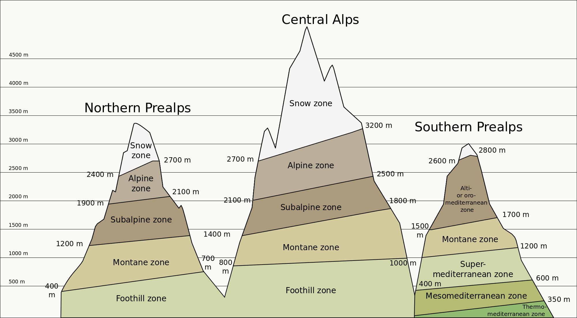
Remember how mountains can focus several climate zones? I think it was in high school I learned this stuff, back when Coe and Eliot glaciers were killing off the mastodons (kidding, I think). Climbing a mountain is like traveling toward the poles, as you get to cooler regions and the trees shrink then disappear. What mountains do over millennia a thunder-cloud can do in three hours! A dry desert heat and a moist sky can produce a cloud that is well below freezing on top (which is often higher than Mt.Everest!). Unlike mountains though, the ice zone can land in the desert for an hour, the cloud moves off, and the ephemeral mountains rebuild off the hot desert again.
14 October 2016
13 October 2016
the Ides of October storm
It's not a real storm nowadays unless it has a name. The Weather Channel uses Norse and Greek gods, the NWS went with the calendar.
Top: clearly not a cold storm, but typhoon remnants generally look like this. Fairly warm downpours, so little range from high to low and not much space between temperature and dew-point.
Middle: here's the wind setup as it stands on Thursday night. After 4PM Saturday steady winds from the south in the mid-40s mph, and gusts to.. 67? Wow: that's about 20mph higher than this chart for Portland, so our proximity to the low and our higher hillside location make a difference. In our specific case we're just on the north slope below a high point, so we'll hear limbs cracking on the 800' crest - hopefully none of them will impale our roof or our vehicles! The yard itself will probably feel the swirling wind to either side, but previous south winds have been blocked quite effectively. However: they were Not sixty-mile plus gusts on those occasions!
Here's the NWS Portland meteogram for our little spot on the map:
Top: clearly not a cold storm, but typhoon remnants generally look like this. Fairly warm downpours, so little range from high to low and not much space between temperature and dew-point.
Middle: here's the wind setup as it stands on Thursday night. After 4PM Saturday steady winds from the south in the mid-40s mph, and gusts to.. 67? Wow: that's about 20mph higher than this chart for Portland, so our proximity to the low and our higher hillside location make a difference. In our specific case we're just on the north slope below a high point, so we'll hear limbs cracking on the 800' crest - hopefully none of them will impale our roof or our vehicles! The yard itself will probably feel the swirling wind to either side, but previous south winds have been blocked quite effectively. However: they were Not sixty-mile plus gusts on those occasions!
interesting reading II
Canada's site at theweathernetwork has a great video with images of Songda (once a Super Typhoon!) and its predicted track
https://www.theweathernetwork.com/news/articles/strong-october-storms-ahead-for-bc-south-coast/72975
Cliff Mass' blog shows great concern, but the MM5 as of this post was still on GFS track from earlier.
https://www.theweathernetwork.com/news/articles/strong-october-storms-ahead-for-bc-south-coast/72975
They also show the Seattle NWS with this dire comment!
Cliff Mass' blog shows great concern, but the MM5 as of this post was still on GFS track from earlier.
And as of 10AM the GFS has "come around" - so maybe 60/40% now on that southern track?
Area Forecast Discussion
National Weather Service Seattle WA
950 AM PDT Thu Oct 13 2016
..the next strong low pressure system will have moisture from former typhoon Songda so that storm should be stronger. The GFS has that low making landfall on the Washington Coast Saturday evening and the GFS track is just right for a genuine windstorm for the interior of Western Washington. It will be interesting to see the 12z ecmwf solution.
fun reading
The NWS discussion has many "interesting" notes today. (They use the word "interesting" often when "dangerous" or "volatile" are equally good choices.)
- First to note is Typhoon Songda - its remnants will reach the USA on Saturday.
- A quick wound-up low will bring back memories of its big winds as they visit Astoria (ECMWF model) or Victoria (GFS). If you live near Astoria, that's an important distinction!!
- The words "180-200kt jet" are also in here - that's a huge amount of wind up high that is potentially available for delivery at lower levels, in the 'proper' conditions.
- Oh yes, they also describe the ECMWF as "sticking to its guns", meaning that its solution has been consistent while others have jumped about. It's hard to pin down such an unstable event.
So: typhoon remnants, really fast jet stream, predicted Low pressure to get winds going, and the most consistently correct model in the world says it will make landfall as close to our home as possible.
Perhaps those south winds will deliver our firewood this year? Not entirely likely - yet several large trees sit on the 800-foot crest of our hill, and our driveway sits about 30' below and north of that crest. Maybe I'll park the Fiat somewhere else on Saturday..
geek alert!
youtube shot (after 25 seconds)
accuweather wind forecast 10/15, model unknown
weather channel - also going GFS and barely mentioning the risk that ECMWF track suggests!
screen shot: ECMWF is scenario #2. Skill tests always put ECMWF and UKMET at the top, GFS a clear tier lower- but tropical systems are notoriously challenging to all models esp. with a 160+ jet stream!
09 October 2016
October starts wet!
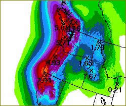
Eight days in and we're about 1½" above the TOTAL amount of rain expected in October! We've had a couple of 1-inch days (and we are doing it again today). The forecast for later in the week still includes several fronts and an atmospheric river slamming into the region - not yet certain where the stream will focus, but someone will get 2+ inches of additional water. Why not us?
Here's the upcoming hit for Wed evening through Friday evening... oof.
02 October 2016
preparing for cooler times
It's looking mighty clear (in a cloudy sort of way) that the warm season has ended. October is two days old and we're at 2/3" of rain, with another inch or two coming this week. I may even have heard a rumble of thunder last night with the intense showers!
So Friday was a hasty clean-up day at our Homely House. Many downed branches were put under cover as firewood, and I finally broke out the electric chain-saw on a smaller tree that I brought down over a year ago. It looks like good wood for a fire now, though the bark needed to come off as it was pretty damp in places. Hopefully we can buy some firewood soon but we have enough to get by - it's not really cold yet, just no longer warm.
I had hoped to bring down some larger branches from the maples this year to be ready in a coming winter but that didn't happen. Maybe next spring.
A late-September storm deprived us of our true-eqnionx sunrise, but two mornings later we were rewarded with a fine view! As of yesterday St.Helens is allegedly covered in a few inches of snow - if only we could get enough clearing to admire its new cloak! This one will and a few more will likely be rinsed off before winter's chill finally allows it to hang about for six months, but it's always fun to see those grey peaks lighten up this time of year.
Subscribe to:
Comments (Atom)


